[ March ( 28 | 29 | 31 ) April ( 1 | 2 | 3 | 4 | 5 | 6 | 7 | 8 | 9 | 10 ) Back to homepage ]
Despite our best attempts, we weren't really ready to set off on holiday on Saturday morning – Jeremy had been doing last-minute proofreading until 4am on Douglas's thesis and Helen spent the morning setting the agenda and printing the paperwork for the next BSR Council meeting. Nonetheless, we eventually left home at 2:15 with the house tidy, the bins emptied and only a few things forgotten.
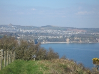
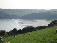
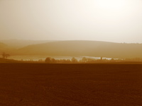
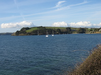
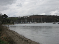
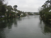
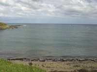
The journey was remarkably good (apart from the Luton bit – we should have used the A1) and we arrived in Frenchay at 5 to see Simes & Rachel, marvel at how much Ollie had grown, and meet Elise for the first time. It was fantastic to see them and they supplied us with much-appreciated tea, fruit cake and apple strudel (Helen having rather more than her share of the last!). We left them (reluctantly) at 7.
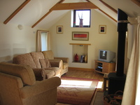
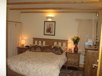
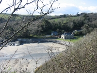
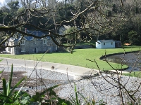
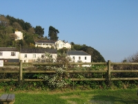
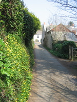
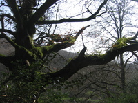
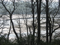
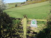
Again, the journey was amazing – almost no delays anywhere apart from the occasional patch of roadworks with 50mph limits and average speed checks. We had originally said we hoped to arrive at about 9 (this was when we planned to leave the house at 11, but were being pessimistic about traffic) and amazingly, we managed it! Anita met us on the drive and waved us into our parking space; and then we got to see the amazing place we're staying for the next week. The ground floor has two bedrooms, a bathroom with spectacular walk-in shower, and a laundry/drying room; the upstairs is an open-plan kitchen cum dining room cum sitting room with lovely Vettriano-style prints on the wall and a wood-burning stove.
|
|
| Sitting room of Trebowan | Bedroom at Trebowan |
Thanks to a modicum of organisation and the wonderful food4myholiday.com, our fridge was ready-stocked with vegetables, local meats and a freshly-made fish pie for supper, which really took the edge of unpacking. There was also a fantastic cheddar from Worthy Farm, although we didn't find that until later. Jeremy sorted out the kitchen and dinner while Helen emptied the cases. Unfortunately we realised there were a few essentials missing from our packing/shopping – notably cooking oil and towels – but given the limited time we'd put into planning, we were delighted to be in such a gorgeous location, with friendly owners and almost everything sorted out – and nothing important to do!
It was fantastic to wake up with no alarm, in a sunny room with the whole day ahead of us. Breakfast was cereal (as usual), bacon and mushrooms on toast, and finally a scone each with strawberry jam and clotted cream. These had been left for us last night as a welcome by Andrew and Anita (who run Higher Menadew Farm) and we'd only eaten half.
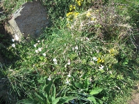
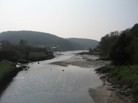
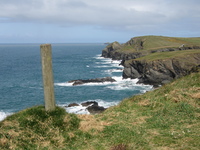
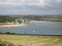
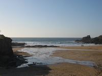
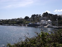
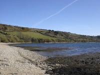
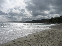
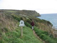
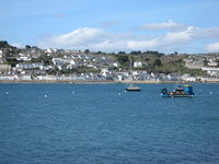
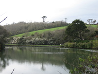
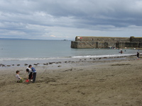
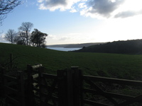
We set off for St Austell to stock up on the things we'd forgotten (like towels) or hadn't found (like local OS maps). We found Tesco with no difficulty; sadly we'd obviously run out of our combined organisational capacity as we got there with neither purse nor wallet! Following a raid on the small stash of coins for the M6 Toll (which yielded £6.05) and a student-style trip round the supermarket adding up totals and buying the cheapest of everything, we had a newspaper, olive oil, bottles of water for walks and some deodorant. And 72p. But that's enough stuff to last for another day so we went on to our planned walk: number 17 from Cornwall walks in the pathfinder guide series.
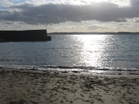
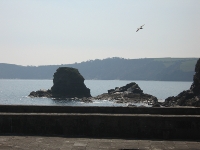
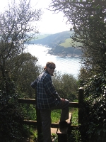
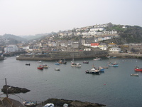
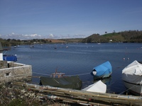
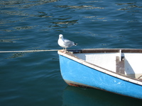
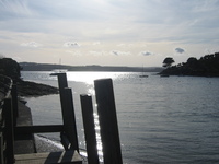
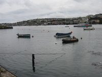
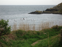
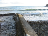
We drove to Polkerris, where there was a pay-and-display car park (disaster!). Then Jeremy realised he'd put a handful of coins in his pocket before leaving in the morning, and that turned out to contain the requisite £2 coin for a day's parking. We walked down to the village and its lovely harbour:
 |
 |
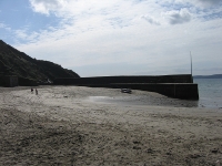 |
| The view down into Polkerris | The view up through Polkerris | Polkerris harbour |
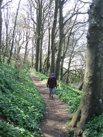
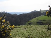
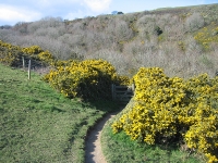
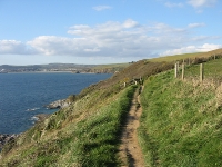
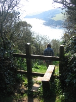
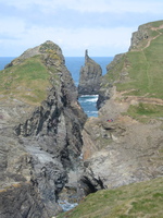
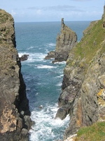
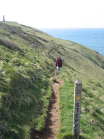
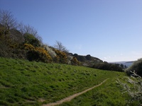
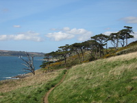
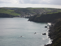
The walk began with a steep, dappled climb through woodland to the cliff tops along the South West Coast Path. It's a circular walk around a headland but we were doing the inland section first, so at the top we turned away from the sea towards Tregaminion.
 |
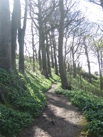 |
| Helen climbing through the woods | Dappled sunshine in the woods |
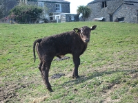
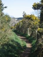
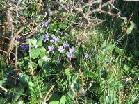
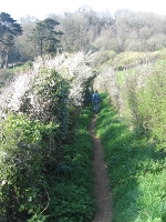
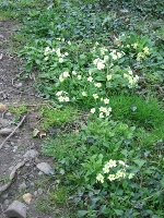
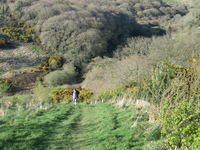
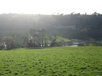
The inland section of the walk was beautiful – not at all the quick route-march you expect when crossing from one lovely coast to another. We passed next to a field with some very new calves at Tregaminion farm, and got our first view of the sea "on the other side". After a gorse-lined track along a field, another patch of dappled woodland and some stepping stones, we met piglets at Lankelly farm. Finally we emerged into the edges of Fowey by a garden full of beautiful daffodils, wandered along a couple of lanes lined with wild primroses and down through woods, and emerged onto the coast for lunch.
 |
 |
 |
| Young calf at Tregaminion | First view of the opposite coast | Gorse-lined track |
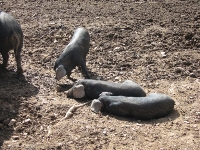 |
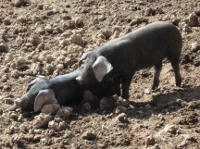 |
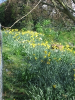 |
| Piglets at Lankelly farm | Piglets at Lankelly farm | Daffodils near Fowey |
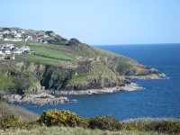
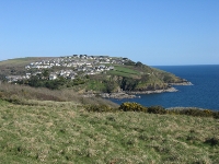
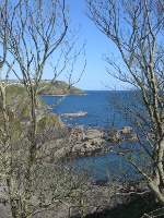
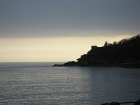
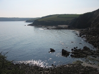
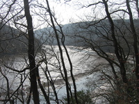
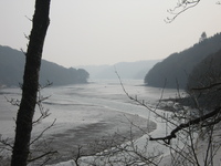
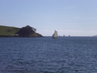
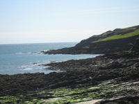
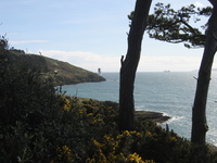
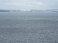
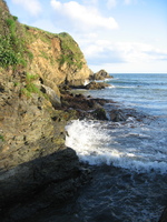
We came out onto the coast above St Catherine's point and sat on a bench facing the sea to have our lunch. To our left we could see across the River Fowey to Polruan; to our right, along the coast to Gribbin Head with the Gribbin Tower daymark.
 |
 |
 |
| Gribbin Head from the West | Polruan, beyond the River Fowey | Polruan |
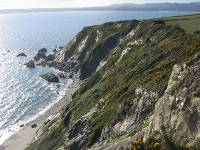
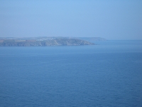
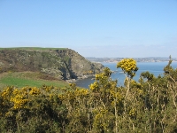
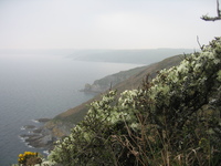
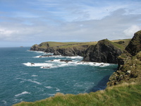
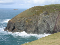
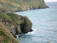
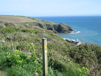
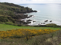
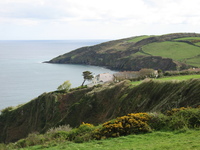
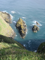
We walked along the coastal path towards Gribbin Head, crossing Coombe Haven and getting some really spectacular coastal views. The gorse was in fantastic colour and we even spotted a wreck (just the crow's nest showing) on the rocks.
 |
 |
 |
 |
| Gorse | View back towards Fowey | The crow's nest of a shipwreck | Coastal view towards Gribbin Head |
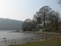
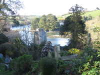
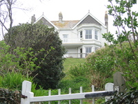
The next cove around was Polridmouth. This bay used to belong to the Menabilly estate (which our walk encircled) where Daphne Du Maurier lived and wrote. There is a house right next to the cove – clearly very desirable holiday accommodation – and a landscaped lake with ducks and swans. As we climbed away from Polridmouth, we were also lucky enough to see a very friendly robin.
 |
 |
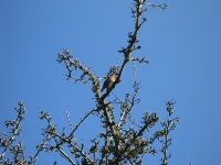 |
| Polridmouth cove | The house at Polridmouth | Robin |
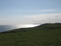
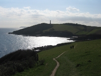
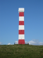
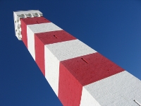
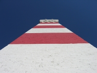
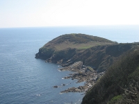
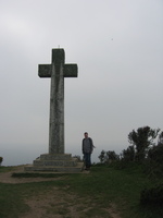
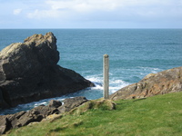
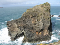
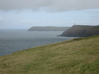
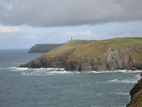
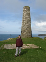
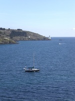
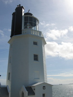
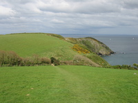
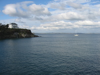
We rounded Gribbin Head (after the imaginatively-named Sandy Cove) to reach Gribbin Tower, a 25 metre high daymark erected by Trinity House in 1832. It's clearly been painted more recently than that!
 |
 |
 |
| Gribbin Tower on Gribbin Head | ||
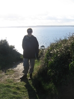
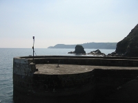
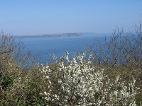
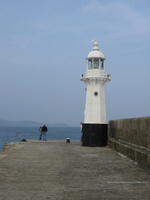
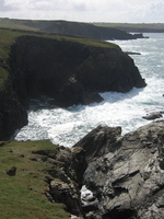
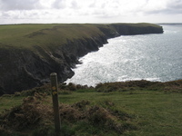
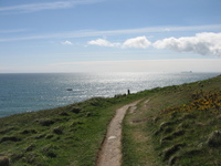
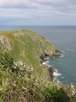
The route back was very straightforward – we just followed the South West Coast Path along the top of the cliffs to Polkerris. The views didn't falter, and we even found hawthorn in bloom (and it's still March!).
 |
 |
 |
 |
| View along the coastal path | Helen and hawthorn | Approaching Polkerris from the East | Polkerris harbour in the evening sun |
We drove home and were again surprised by just how lovely our cottage – Trebowan – is. Jeremy cooked duck breasts (again, from the pre-stocked fridge) for supper.
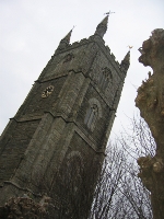
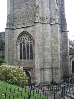
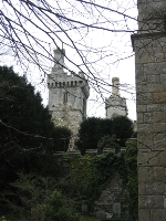
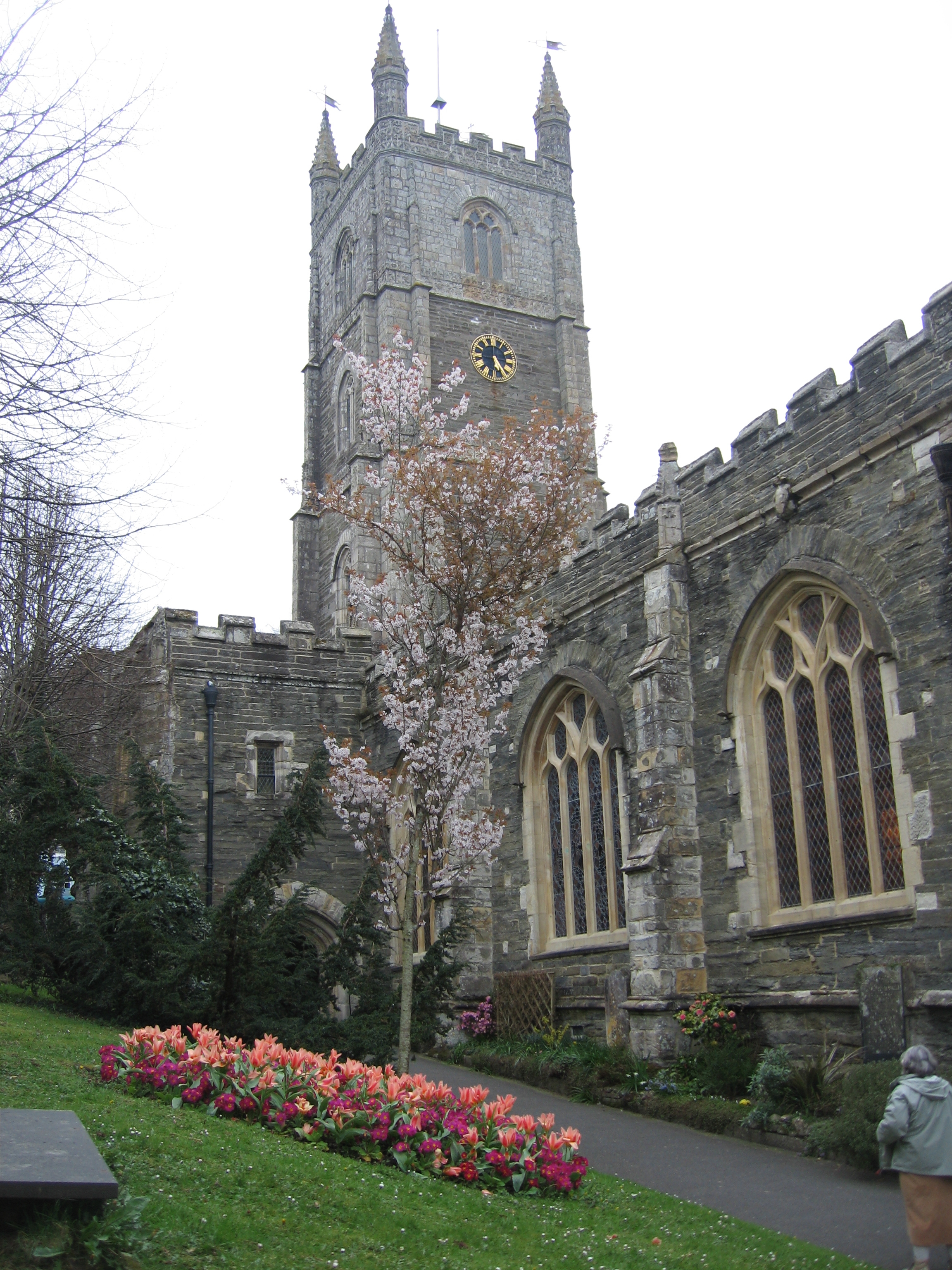
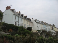
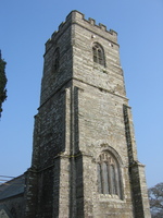
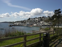
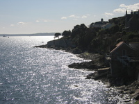
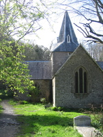
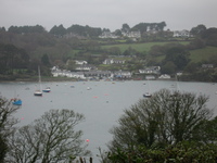
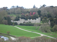
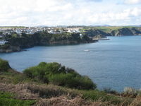
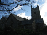
An easy day. In the afternoon we drove to Fowey to have a look round. It's a lovely quaint harbour village, full of steep slopes, steps and snickets. The parish church is delightful, and just behind it is what looks like a fully-fledged castle but is privately owned.
 |
 |
 |
 |
| Fowey parish church tower | The hidden castle at Fowey | Fowey church in springtime bloom | |
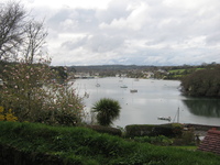
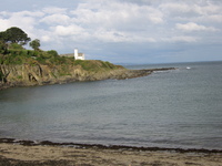
We walked down to the waterfront for a view out along the estuary, with the two blockhouses either side, from which a chain used to be suspended to ward off invasions. Exploring within the village, we found the Grammar School Garden – a lovely little corner!
 |
 |
 |
 |
| Estuary of the River Fowey | St Catherine's Point | Fowey street | Helen in the Grammar School Garden |
 |
 |
 |
|
| Navigation light at Fowey | Blockhouse near Polruan | Blockhouse near Fowey |
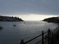
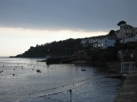
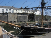
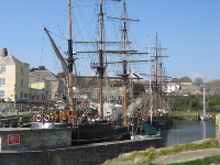
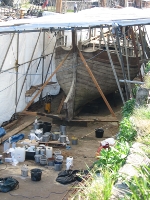
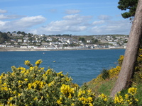
The weather was spectacular – even better than on Sunday – so we headed to the coast. Driving through St Austell, we went down to the sea at Charlestown, whose name we knew as the home of many of the best restaurants in the area. When we got there we discovered a small harbour complete with tall ships being actively repaired.
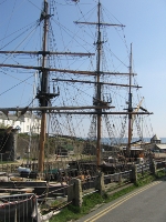 |
 |
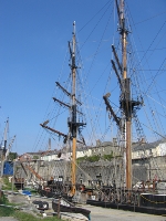 |
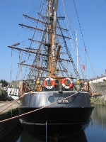 |
| Tall ships at Charlestown | |||
 |
 |
 |
|
| Charlestown harbour | Tall ship at Charlestown | Seagulls at Charlestown | |
 |
 |
 |
|
| View from the end of Charlestown harbour | Boat under repair at Charlestown | ||
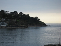
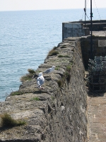
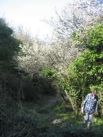
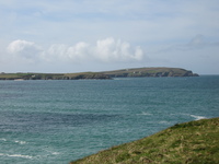
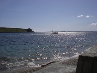
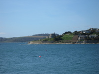
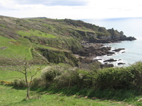
We drove on south along the coast towards the Ropehaven Cliffs Nature Reserve, and parked above it (near Trenarren) where the South West Coast Path touches the lane. There we set off along the coast path, initially through woodland and then along cliff edges in sunny fields. After an hour or so we reached the headland of Black Head, which was apparently once a fort, and made that our lunch stop.
 |
 |
 |
 |
| Helen climbing past hawthorn blossom | View back towards Charlestown | View of Gribbin Head | Black Head |
 |
 |
 |
 |
| May blossom | Memorial on the approach to Black Head | View north from Black Head | Twinkling seas from Black Head |
 |
 |
 |
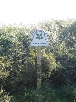 |
| The end of Black Head | Wild flowers | Black Head sign | |
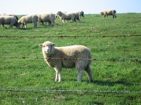
On leaving Black Head, the walk continued to be beautiful (and not too strenuous) – there were young-ish lambs, dappled stiles, and of course the lovely coastal views.
 |
 |
 |
| Curious lamb | Helen at a stile | Heading towards The Vans |
 |
 |
 |
| The cove before Sconhoe Beach | Field-side path | Chaffinch singing on a stile |
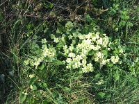
At one point we encountered some slightly odd sculptures just as we were entering woodland at The Vans; we also saw some of the best primroses of the holiday so far!
 |
 |
 |
| Woodland sculpture | Primroses | |
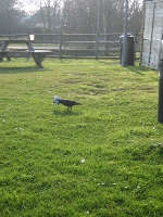
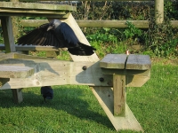
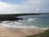
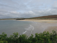
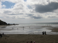
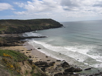
Finally we rounded the last headland and got our view of Pentewan Beach. We walked on together to Pentewan, where Helen stopped. Jeremy did the inland hike back to the car (probably another mile and a half on top of the 3 and a bit we'd done already) while Helen sat outside the Ship Inn in Pentewan drinking lemonade and watching the crows.
 |
 |
 |
 |
| Pentewan beach | Crow playing with a crisp packet | Crow in flight | Pentewan |
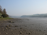
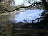
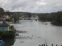
We drove to Lerryn, a route that involved almost nothing bigger than a B-road, to do walk 1 of Cornwall walks. The weather was just as sunny but a little colder. Our route started in a car park which had fun notices saying it would flood at high tide! We went into the village to cross the bridge as the walk was on the other side of the river.
 |
 |
| View from Lerryn bridge | The lane leading to the riverside |
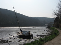
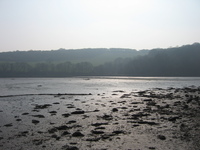
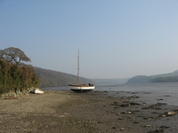
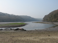
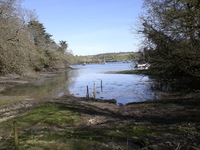
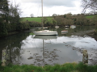
The outward half of the walk was along the bank of the River Lerryn (becoming the River Fowey as it heads downstream). The tide was out, which the book seemed to think would make life less picturesque, but the landscapes were beautiful. We stopped for lunch on a bench facing the river.
 |
 |
 |
 |
| Boat on the mudflats | Ethy Woods sign | Tree growing ferns | Uniform density of canopy |
 |
 |
 |
|
| View downriver | View from our lunch spot | Across the sandbanks |
After crossing a couple of fields, we reached a stretch where the path was actually in the river bed. At high tide, apparently, we would have had wet feet. Here we came across the gorgeous St Winnow Church (favoured by film makers according to our guide), right on the edge of the river. We stopped for a drink in the churchyard.
 |
 |
 |
 |
| St Winnow Church | Jeremy at St Winnow | Helen and the River Fowey | Looking upriver |
 |
 |
 |
 |
| Across the river | Boat on a sandbank | Looking downriver | St Winnow Church |
 |
 |
||
| St Winnow churchyard | Primroses in St Winnow churchyard |
The return route was further inland, climbing through fields and passing the stately home of Ethy (which looked newer than we expected). We finished back at Lerryn, where we crossed the river on stepping stones directly to the car park.
 |
 |
 |
| Looking back over St Winnow church | Looking back over the River Fowey | Helen climbing a field |
 |
 |
 |
| Private garden near Ethy | View downriver from the stepping stones | View of Lerryn bridge from the stepping stones |
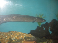
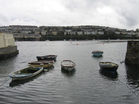
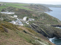
We went out for lunch today – to Charlestown, which we'd visited on Wednesday and looked very attractive. After wandering up and down and inspecting the menus, we settled on "The Wreckers", a bistro-style café. Helen had a fishcake platter (two enormous home-made fishcakes with salad) and Jeremy a tempura fish fry. The fishcakes were better. After lunch we drove to Mevagissey, which has spectacularly narrow streets and a surprising car park at the end of the harbour. We parked and walked to the end of Stuckumb Point, then climbed steps up above the harbour and descended gradually round into the village. On the way back in we went in the tiny aquarium and were surprised by how good it was: lobsters attacking starfish and a massive conger eel!
 |
 |
 |
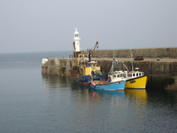 |
| Mevagissey lighthouse | Mevagissey harbour | Conger eel at Mevagissey aquarium | Stuckumb Point, Mevagissey |
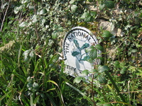
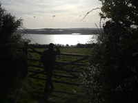
Next we drove to Penare for a rather short and blustery walk. We took a track from the National Trust car park to a small right-to-roam region on the end of Dodman Point, which has a circular walk around it. It's cut off by a bulwark, which is apparently the remnant of some old strip-farming settlement. As we went up the track it was lovely and sunny, but that soon disappeared and we had a quick yomp round the end of the point. From the end you're supposed to be able to see Goonhilly, but we couldn't even see the horizon. Impressively, right on the most exposed tip of land, the hawthorn was in bloom. The coastal section of this walk is part of a much longer walk that we may try (in better weather) later in the holiday.
 |
 |
| Jeremy at Dodman Point | Hardy hawthorn at Dodman Point |
We were packed and out of Higher Menadew pretty efficiently – only 20 minutes after the required 10 o'clock – and rang ahead to see if it would be OK to go to the next place and at least drop off perishables in the fridge and freezer. It turned out there had been no-one in the previous week so we had free rein: so after a quick stop at Tesco in St Austell, we drove straight to Trevennel Cottage and unloaded the car.
The new cottage is very different from the last: part of an old house and decorated accordingly, the kitchen and bathroom are rather small but the bedroom is huge with lots of storage space, and the living room very cosy and warm.
The weather was looking very good, so rather than unpack properly we dumped the cases and headed off for a walk. Even after all the moving we still had a very good start, so we decided to make use of it and head over to the north coast. We chose walk 10 of Cornwall walks, which explores the coast just west of Padstow.
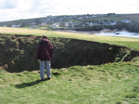
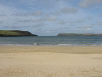
The walk starts from a car park on Trevone Bay (a shocking £3.50 for the day!) and immediately heads along the cliffs on the South West Coast Path. The weather looked as if it might deteriorate and then didn't, which was a bonus. We had lovely views of the surf crashing on the rocks, and almost immediately came to the imaginatively-named Round Hole. This is an impressive, erm, round hole in the ground, quite a way inland, which goes right down to the sea below.
 |
 |
 |
| Trevone bay | View across Trevone bay | Waymark on the cliff edge |
 |
 |
 |
| Cliff view | Helen looking down Round Hole | Round Hole |
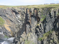
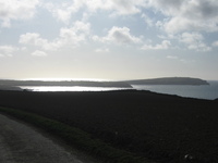
We walked along the north coast, looking at the impressive rock strata, and a rather good double rock bridge at Porthmissen. There was a startling pinnacle of rock offshore, and we stopped to have our lunch in the shelter just before a local top, with a view of Gulland rock.
 |
 |
 |
 |
| North coast near Trevone | Rock strata | Porthmissen bridge | Contorted rock strata |
 |
 |
 |
 |
| Spectacular rock pinnacle | Gulland rock | Rock pinnacle | View westwards towards Trevose Head |
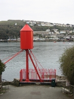
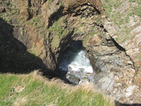
The next section was mostly a gentle climb, slightly windy, but over springy turf and very enjoyable walking. The last bay before Stepper Point is called Butter Hole, and has some very blue slate strata in its cliffs. The daymark on the point gradually came into view; known as the Pepperpot, the book claims it's dangerous to explore, but it looked pretty solid to us.
 |
 |
 |
 |
| First glimpse of the Pepperpot | Butter Hole | Looking back from Stepper Point | |
 |
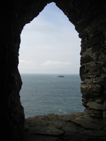 |
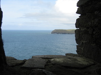 |
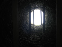 |
| Helen at the Pepperpot | View through a Pepperpot window | View straight up through the Pepperpot | |
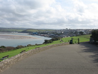
Beyond Stepper Point, we cut down in front of a Coastguard lookout, and came out of the wind and into views of Padstow Bay. We descended to the beach and stopped for coffee and biscuits and watched a family learning how to fly a stunt kite (quite fun, but we were glad to be out of string's length!).
 |
 |
 |
| Helen descending from Stepper Point | Padstow Bay | Looking out over Padstow Bay |
 |
 |
|
| Out to sea from Padstow Bay | Inland from Padstow Bay |
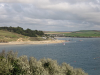
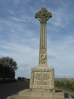
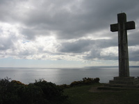
We followed the Coast Path along almost to the outskirts of Padstow, where there is a War Memorial overlooking the bay, with lovely views. The rest of the walk was a rather functional yomp back across the headland to Trevone Bay, except that as we topped the head and came down towards our start point there were fine twinkling seas in the lowering sunshine.
 |
 |
 |
 |
| Entrance to Padstow War Memorial | War Memorial | Last views of Padstow Bay | |
 |
 |
 |
 |
| Approaching Trevone Bay for the end of our walk | |||
We drove home, pausing for petrol and a couple of things we'd forgotten in the morning, and had a relaxed evening of prawn risotto and unpacking. The low table in the sitting room turned out to be just what the jigsaw needed.
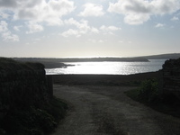
The weather was the best yet, so we decided to have a walk with no car transport involved. Mr. Morse had told us there was a permissive footpath down through the farm to Percuil Creek, so we planned to use this to the coast, then follow a footpath round to St. Mawes and (if it was running) take the ferry across to St. Anthony Head and walk 9 of Cornwall Walks.
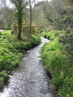
We had a little difficulty at the beginning of the path – the first stile was very overgrown – but we'd seen a footpath arrow so we had confidence. Then we came to a place where there was a sturdy fence right across the path. Since we had the official word of the landowner, we carried on with confidence, climbing the fence and following a delightful dappled footpath along the side of the stream.
When we came to the end of the Creek the path turned right, and us with it; and it gradually became more private-feeling, with stone benches and steps and a general aura of "garden belonging to a big house". Eventually we rounded the next headland (where a proper footpath was marked on the map) to find a thick layer of barbed wire between us and where we were supposed to be. We walked in the bed of a stream and climbed in over a bridge to reach legality.
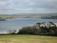
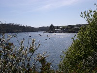
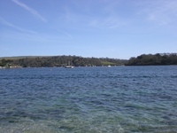
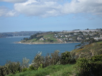
From there on it was straightforward – the footpath stayed mostly at the water's edge and we had pleasant views of the eastern outskirts of St. Mawes. We reached the main harbour – the first really touristy-feeling place we'd been – at about 2:30.
 |
 |
 |
| View from the end of Percuil Creek | Looking east from the St. Mawes peninsula | |
 |
 |
 |
| Quayside east of St. Mawes | Approaching St. Mawes | |
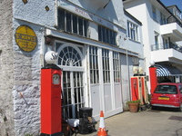
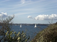
St. Mawes harbour is lined with hotels and cafés, filled with yachts and small boats, and well-populated with seagulls. Unfortunately the ferry to St. Anthony Head doesn't run until Easter (next week) but there is a chap with a boat who essentially runs a taxi across the bay. We decided to make today's walk into a circuit around St. Mawes itself, and save the other headland for another day. We took some steps down onto the quayside and ate our sandwiches (and wrote our postcards) in the sun.
 |
 |
 |
| Petrol station at St. Mawes | Seagull | View out from our lunch spot |
 |
 |
 |
| Boats at St. Mawes | The sea wall | Sailing past St. Anthony Head |
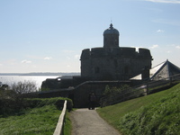
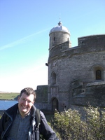
Next we headed along the coast towards St. Mawes castle. This is one of a pair with Pendennis Castle at Falmouth, and bills itself as "Henry VIII's most picturesque fort". We didn't go in, but the path around the outside – lined with hawthorn – was very attractive.
 |
 |
 |
| Lighthouse on St. Anthony Head | Coastline from St. Mawes | St. Mawes castle |
 |
 |
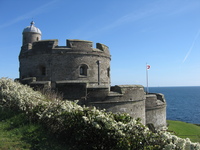 |
| Crenellation at St. Mawes castle | Jeremy and St. Mawes castle | St. Mawes castle |
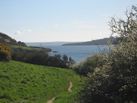
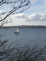
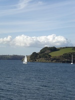
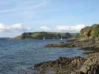
We headed along the coast from the castle, through National Trust property along some delightful mown paths. We were always by the sea and got some lovely views of yachts sailing. At one point we walked down to the shore and found sea anemones in a rock pool.
 |
 |
 |
 |
| View back towards St. Mawes castle | Tregear Vean sign | Hawthorn on the coast | Path between hawthorn and gorse |
 |
 |
 |
 |
| Yacht on the Fal | Looking back at our path | Two yachts | Yacht at Messack Point |
 |
 |
 |
 |
| Yachts near St Just | Sea anemones in a rock pool | St Just in Roseland | |
Our path came out into the village of St-Just-in-Roseland itself, which seems to be a single road down to the quayside. The church is very attractive, and has tropical plants all around it. We took a gently climbing footpath back to the main road, which came out almost opposite the entrance to Trevennel Cottage.
 |
 |
 |
 |
| The quay at St. Just | The church at St. Just | Looking across the bay from the footpath home | |
In the evening we decided to go out for dinner – for the first time this holiday – and booked into the Roseland Inn in Philleigh. This is a proper gastropub, with a dining end but happy for you to eat very good food in the bar area. Jeremy had scallops followed by a three-seafish dish; Helen had a venison and cashew nut stew. We finished with a shared hot chocolate fudge cake. Everything was really excellent – including the seat by the fire. On the way there, and again on the way back, we saw an owl by the side of the road. First it was on the hedge, then on a Give Way sign, and finally we saw it flying alongside the road. Very impressive!
Today was predicted (rightly) to be a bit rainy so we took it easy in the morning, with brunch and crossword in bed and a general air of relaxation. After lunch it perked up a bit so we decided to go for a short walk on the other side of the River Fal. We drove to the King Harry chain ferry (runs every 20 minutes for most of the day) and were lucky to catch the 2:10. From there we drove through the charmingly-named "Come-to-Good" and down just north of Penryn to a tiny place called Tregew.
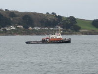
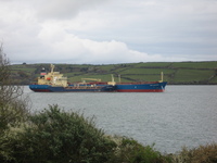
We walked down through some horrible cabbagey fields into Flushing, and from then on we were on the front for practically the whole time. We had good views of Falmouth and the ships in dock there; we saw two small girls with a large collection of live crabs they'd caught, and lots of very energetic dogs being walked (or run). We finally came round to the Mylor Yacht Club, where we stopped to drink our coffee and Jeremy helped a chap put the string through the cover of his boat. Then we turned inland for the muddy climb back up to the car.
 |
 |
 |
| Small boats at Flushing | Very low in the water off Trefusis Point | |
 |
 |
 |
| The Clipper Beaune and the Nord Organiser | Huge ship waiting outside Falmouth | Mylor yacht club |
 |
 |
 |
| Mylor Creek | Tranquil Trelew | |
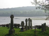
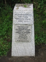
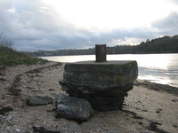
On our return via the King Harry ferry we made a detour to Turnaware Point, from where many troops embarked for Omaha Beach in the D-Day landings. There was a long concrete approach road, built for the purpose, and a wide concrete apron – but of the "biscuit" construction into the water there was only a single chunk of concrete remaining. Frankly a bit disappointing!
 |
 |
| War memorial at Turnaware Point | Single biscuit at Turnaware Point |
In the evening we drove to Portscatho to eat at the Plume of Feathers. It was very friendly but not quite as impressive as the night before. We shared fish goujons to start, which were really excellent; then Jeremy had mussels (not quite hot enough and with some crunchy bits) and Helen a vegetable curry (fine but not very exciting).
We had a very laid-back morning of laundry and jigsaw, and had lunch at home before heading out to Veryan (not a long drive). The walk was number 20 of Cornwall Walks (the last one rated medium, or blue, before the dangerous red ones). We parked in Veryan a little way away from the path – and a long way away from the official start point; we started about 3/4 of the way round and cunningly got the longest stretch of road walk out of the way at the beginning.
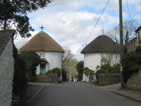
Veryan is very pretty, with an old church, a scenic pond, and a pair of unusual round houses which were apparently supposed to provide no corners for the devil to hide in. From there, we walked down the road to a "working" watermill at Melinsey, where they were pumping the water up to make the wheel turn! Once we turned off the road, there was a very attractive woodland walk down to the sea, cutting through a farm at Lower Mill over a stream.
 |
 |
| Round houses in Veryan | Stream at Lower Mill |
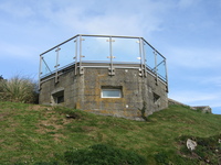
We reached the coast at Pendower Beach, where we briefly went down to the shore. There was an option of walking the next stretch along the beach, but as the tide was in we couldn't take that path. Instead we used the Coast Path to Carne Beach – the official start point of the walk – where someone had enterprisingly converted a pillbox into a sort of summerhouse.
 |
 |
 |
 |
| Pendower Beach | Converted pillbox at Carne | ||
We followed the Coast Path (which was getting rather blustery by then) past Tregagle's Hole (haunted, according to the noises you hear in stormy weather!) and on to Nare Head. This was a slight detour but worth it to be absolutely on the end of the headland.
 |
 |
 |
 |
| Tregagle's Hole | Nare Head sign | Helen at Nare Head | Jeremy at Nare Head |
Once we rounded the headland it was, if anything, even windier, but we had views of Dodman Point (where we'd been on Friday). After descending to Kiberick Cove there was a pretty strenuous zigzag climb up below a grey-white house. When we reached it it displayed a notice saying it was available for B&B, and had been the location of "The Camomile Lawn" on TV several years ago. After that climb, we decided to pass on the option to descend into Portloe (a picturesque village but it didn't look better than Fowey) and instead skirted it on a path through fields.
 |
 |
 |
 |
| Lemoria Rock | Clifftop grasses | Setting of the Camomile Lawn | Portloe |
The walk back to Veryan was a pleasant, gradual climb through fields and coming out into the recreation ground by the church. As we got back to the car, it started to rain for the first time – perfect timing if only we hadn't left the washing out! In the evening we finished the jigsaw.
 |
| Finished jigsaw |
The weather looked pretty good, so we headed off slightly more efficiently this morning to walk 9 of Cornwall Walks. We drove over to the next headland to the East – not a long drive and certainly not worth our earlier plan of walking to St. Mawes and getting the ferry across – and parked at Porth Farm.
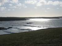
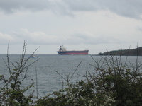
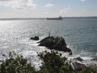
The path was very quick to the coast – coming out at Towan Beach – and we immediately turned right along the low cliffs. The views were good from the very beginning, and when we reached Killigerran Head with its sight of the ships queueing for Falmouth we stopped for lunch and a laze in the sun.
 |
 |
 |
 |
| Rocks at Towan beach | Towards Killigerran Head | Seagulls being sweet | View over Veryan Bay |
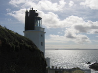
The next stretch of cliff led to St. Anthony Head (with a peek over Zone Head towards St. Mawes on the way). There is a disused gun emplacement (used until 1956) at the end, and further round the working lighthouse – closed to the public, of course, but we were able to get close enough for a good look.
 |
 |
 |
| Pendennis castle from Zone Point | St. Mawes headland | St. Anthony's lighthouse |
 |
 |
|
| Oystercatchers off St. Anthony Head | St. Anthony's lighthouse |
We continued on the South West Coast Path past the pretty Molunan Beach, and round Carricknath Point, from where we got proper views of St. Mawes and the yachts (and lobster-fishing boats) in its harbour. The castle was looking particularly good in the sunshine.
 |
 |
 |
| Scots pines near Molunan Beach | St. Anthony's lighthouse | First view of St. Mawes |
 |
 |
|
| Gathering lobsters at St. Mawes | St. Mawes Castle |
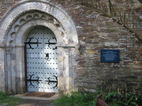
We cut inland past Cellars beach and behind Place House, with its yellow frontage, and the 12th/13th Century St. Anthony-in-Roseland Church.
 |
 |
 |
 |
| Blossom at Place House | St. Anthony-in-Roseland church | Place House | |
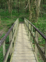
Just beyond Place House is the place where the ferry from St. Mawes comes in (after Easter at least) and a signpost saying it's just 1 and a half miles back to Porth Farm; but the book warned us it would take an hour. The path was very pleasant – winding through woodland with primroses and other flowers underfoot – and came out onto fields just before Froe, where it crossed a scenic inlet (or pill) on a long footbridge. From there it was a short pull back up to the car.
 |
 |
 |
| Footbridge across the pill head at Froe | Porth Creek at Froe | |
In the evening we went out to Veryan and had dinner in the New Inn. Jeremy had chilli King Prawns (good but very messy) and steak and kidney pie; Helen had garlic mushrooms and lasagne. It was all excellent but we were quite thoroughly full by the time we'd finished.
The weather finally let us down today (it was bound to happen). After having lunch at home, we had an expedition that started out being for provisions – primarily milk, with a few add-ons – and ended up containing a short wet walk as well. We drove to Helford, not far from Helston, and parked. We were loosely basing our route on walk 12 of Cornwall Walks, but with an abrupt shortcut to avoid getting totally soaked.
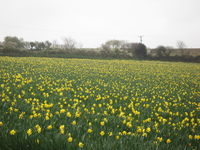
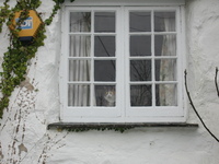
We walked straight to Manaccan by the most direct route – the road – and were surprised to see daffodils being grown as a crop! When we reached Manaccan we had a brief exploration, looking at the attractive church and shop that Jeremy remembered, and then branched out onto a footpath back towards the coast.
 |
 |
 |
| Across the bay to Porth Navas | Field of daffodils | Cat in a window at Manaccan |
The route back was through woodland – very attractive if a little squelchy underfoot – and came out to a wooden footbridge over the creek at the head of Helford village. There was a ford, clearly impassable at high tide (which it was), and a very short step up the road brought us back to the church and car park.
 |
 |
| View from the head of Helford | Helford church |
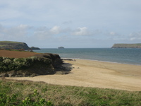
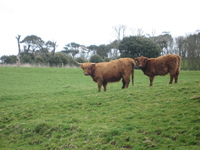
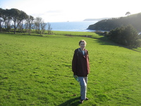
For our last day the weather dawned fine and sunny (what a contrast!) so we made a good start and drove to Porthluney Beach, right by Caerhays Castle. This well-positioned carpark is free – we liked that. The planned walk was number 28 (the last one!) of Cornwall Walks. We set off along the South West Coast Path (why break with the habit of a fortnight) past some surprisingly hairy cattle, and found the first stretch really quite arduous, with steep climbs and immediate descents, until we got round to Greeb Point.
 |
 |
 |
| Porthluney beach | Highland(!) cattle | Caerhays castle |
 |
 |
 |
| Towards Greeb Point | Towards Greeb Point (with gorse) | Hemmick beach |
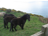
The next stretch led us to Dodman Point (which we'd visited last Friday) and was quite a pull up. As we broached the bulwark which cuts the headland off, we were surprised to meet Dartmoor Ponies – there as part of a conservation programme – and also more people than we'd seen since we left the beach at the beginning of the walk.
 |
 |
 |
| Dartmoor ponies near Dodman Point | Dodman Point | |
We had our lunch just beyond Dodman Point – and while we were sitting there, were surprised by what sounded like thunder, but if anything lower and more diffuse. There were a few spots of rain and it looked as if our grand walk might not be as grand as we'd hoped: but nothing more came of it.
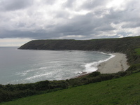
From Dodman Point along the coast to Gorran Haven was much easier going than the first stretch had been, and entirely appropriate for that slightly dopey bit after lunch. We passed another promising looking beach – Bow Beach – but this one had no surfers and very few people in total: maybe because the sands weren't quite so golden there?
 |
 |
| Bow Beach | Gorran Haven |
At Gorran Haven we had a decision to make. We could yield to tiredness and climb a dreary road short-cut, giving us about an hour and a half walk back; or we could push on along the coast for a more pleasant but longer walk. If the timings in the book were to be believed, that longer option would have us finishing the walk at close to 8pm... Nonetheless, seeing a spot of sunshine ahead on Maenease Point and baulking at the uphill road walk, we decided to take the longer option. It turned out to be a good decision. The coast path to Maenease Point and beyond to Portmellon was much more level than what we'd already traversed, and the sun came out. The white houses of Chapel Point looked very sweet as we headed towards them round the point.
 |
 |
 |
 |
| Leaving Gorran Haven | Path to Maenease Point | Coast south of Maenease Point | Looking back to Gorran Haven |
 |
 |
 |
|
| Rocks off Maenease Point | Chapel Point | ||
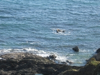
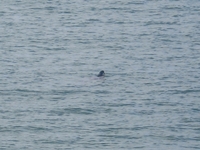
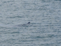
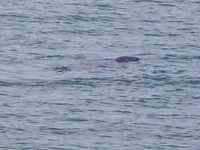
When we got to the beach by Chapel Point, there was a seal swimming in the bay. Very difficult to photograph, but it really was there!
 |
 |
 |
 |
| The bay by Chapel Point | Seal at Chapel Point | ||
Once we'd left the seal behind, we climbed gently to the cliffs above Portmellon, where we paused on a bench for coffee and biscuits. A fishing boat was clearly throwing out discarded fish, to judge by the numbers of seagulls it had following it.
 |
 |
 |
| Fishing boat with gulls | Mevagissey | Clifftop house at Portmellon |
From Portmellon we turned inland and into the West Bodrugan Wood nature reserve. This was beautiful – no bluebells yet, but plenty of primroses and dappled sunshine. As we left the nature reserve, there was also a really steep pull up before we got to Gorran Churchtown. This is completely separate from Gorran Haven, and contains (surprise!) a church.
 |
 |
| Climb up to Gorran Churchtown | Gorran church |
The final stretch was gently downhill through fields and along tiny lanes, and ended with us cresting the hill where we'd originally gone up, opposite Caerhays Castle.
 |
 |
 |
 |
| Last descent to the sea | Caerhays Castle | Happy tired Helen | Happy tired Jeremy |
We decended to Porthluney Beach, where the tide had come in, and watched the waves before setting off for home.
 |
 |
| Waves at Porthluney Beach | |
On the drive home (difficult, driving into the low sun and avoiding the stupid pheasants) we found a barn owl flying along the road between the banks. We must have followed it for about 1km before it finally found a side turning and made its escape!
In the evening we went back to the Roseland Inn at Philleigh (as on Sunday) for dinner. Jeremy had fishcake (with a bit of help from Helen), steak, and a raisin bread-and-butter pudding; Helen had seabass and a chocolate brownie with clotted cream. Perfect Cornwall!
[ March ( 28 | 29 | 31 ) April ( 1 | 2 | 3 | 4 | 5 | 6 | 7 | 8 | 9 | 10 ) Back to homepage ]